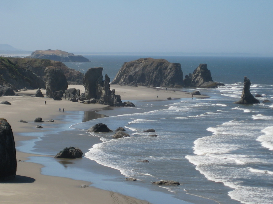
We drove our last stint on the Southern Oregon Pacific Coast Highway, and now we're here in California.
We started not so early this morning in Coos Bay, OR after a standard breakfast at a huge Fred Meyer's All-In-One Stop (and there's a reason for that) near the water.

The Scenic By-Way started in Bandon, OR, where, just outside of town, at "Coquille Point - Oregon Islands Beach" we saw another beach that looked more like a masterpiece.

I'm not the only one who had the same thought, as this beach has been apparently used in 1982 (finally something younger than myself, that I could have actually witnessed! ) to shot a Budweiser commercial that featured Baron, the Budweiser Clydesdale running along the beach. I've heard that Chevrolet, Canon Copiers, and Jeep have also filmed commercials here, and as I said, I'm really not surprised, as this place is really amazing in its wild beauty.

After Bandon Beach, we visited a series of other spots that were indicated in a bigger map I've seen on top of the cliffs in the car parking area.

First stop was Face Rock, and I'll just put a picture for you to comprehend what I'm actually talking about:

Second stop was Port Orford, where "Ocean View" written in huge capital letters on the asphalt invited us (and every other tourist in town) to take a detour to admire the view from up the cliffs.

We took their advice, and this is the result:

We then stopped at another very important landmark on the Oregon Coast, Cape Sebastian, where the Pacific Coast Highway 101 almost meets the ocean. There's a very scenice view point (or Vista Point as they like to call it here in California), and here are some of the pictures I have taken.
Road Sign:

Panoramic View from up the hill:

Side of Hwy 101 at Cape Sebastian:

After we left Cape Sebastian, we stopped at another wayside that "advertised" Arch Rock, that by the way, we haven't seen, mainly because it was too windy out and we didn't feel like walking downhill on a gravel path. This is a picture of the Panorama at the parking lot, we thought it was beautiful enough, and felt immediately satisfied with it!

We then stopped at another parking lot, but this time, due to the more satisfying weather conditions (the place was somehow sheltered from the strong wind), we went all the way to the view station for "Natural Bridges Cove" at Samuel H Boardman State Park.

Now, that was something everybody should see, and here's a picture I've taken, hope you enjoy it as much as I did:

That was our last stop in Oregon as we finally approached the border with California!
Obviously, I couldn't help but snapping a picture of this historical event:

After a few mile, we hit the beginning of the Redwood National and State Parks System, in the town of Crescent City, where we stopped at the Park's Main Office, and grabbed a map, to have a much clearer understanding of the best route to follow.

I'm glad we did that, as we found a nice detour on the "Newton B Drury Scenic Parkway", where we had the chance to take several different pictures.
I'm still amazed at how big the Redwoods are, but hey, here are some pictures for you with smaller objects so that you can make a comparison.
Here's "The Bud" and an average Redwood on the side of the road:

Here's An Italian Across America inside a Redwood:

And in this one I have the section of the trunk of a fallen Redwood at my back:

We also had the chance to see on the same Scenic By-Way, another big Redwood, called "Big Tree" for its size, who is believed to be the oldest of the park:

The picture I have taken doesn't really do any justice to what the real "Big Tree" looks like, The tree is 304 feet tall and 21 feet in diameter.
We're now in Eureka, where we're going to spend the night, and where our journey will take us tomorrow through the "Avenue Of The Giants", which means, more big trees to come!!!
Have a very good night my friends,
Nico


No comments:
Post a Comment